About Yao
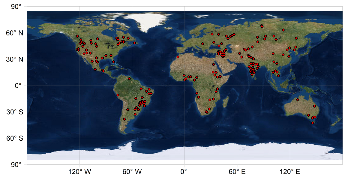
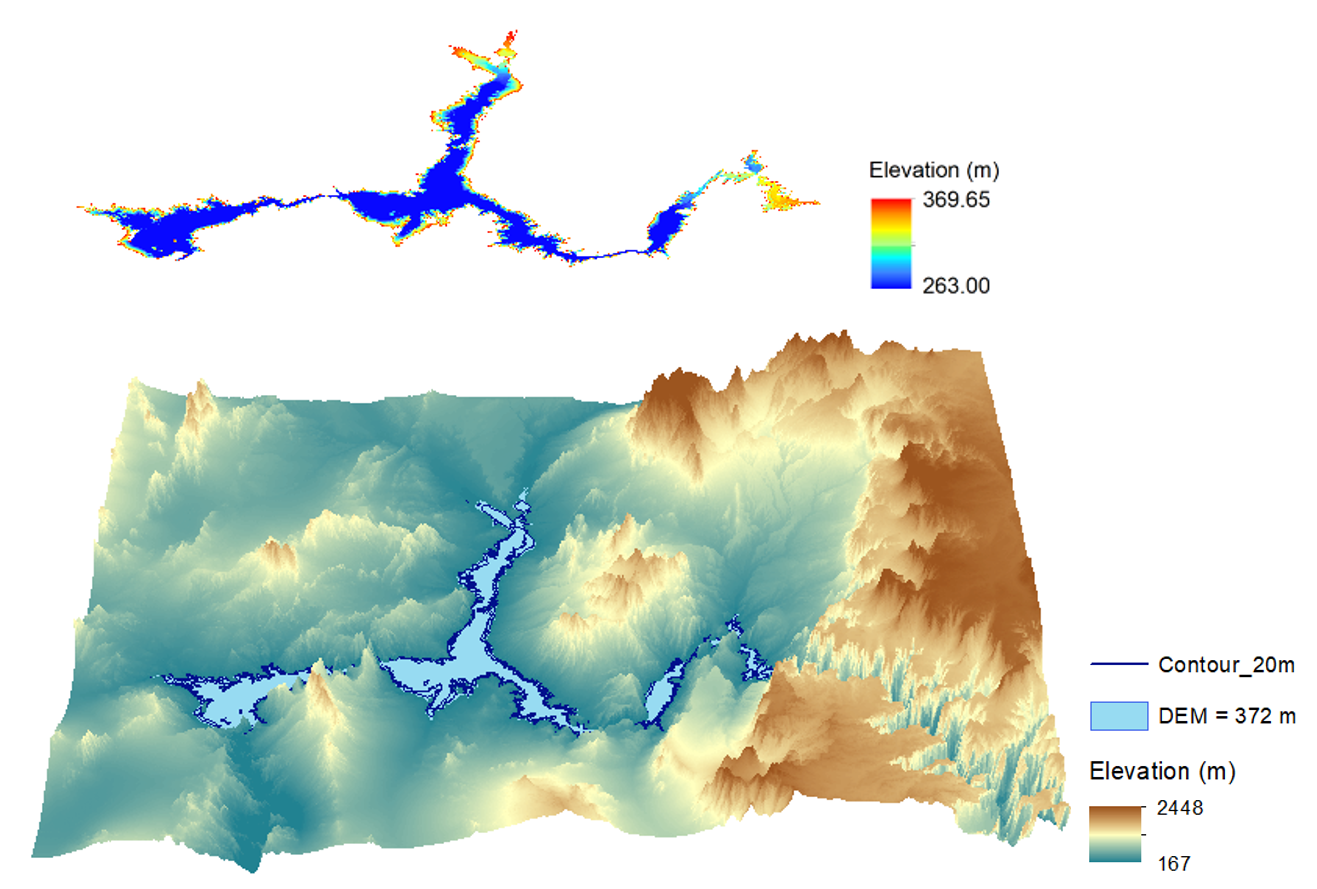
I am a remote sensing scientist specializing in inland waters and coastal oceans. I leverage multi-source satellite data to derive the bathymetry and monitor the storage variations for global reservoirs.Additionally, I use remote sensing data (e.g., satellite ocean color and field spectroscopy) to address the coastal ocean problems. I am currently a Professor in School of Geographical Sciences, Southwest University.
Interests
- Remote sensing
- Water resources and quality
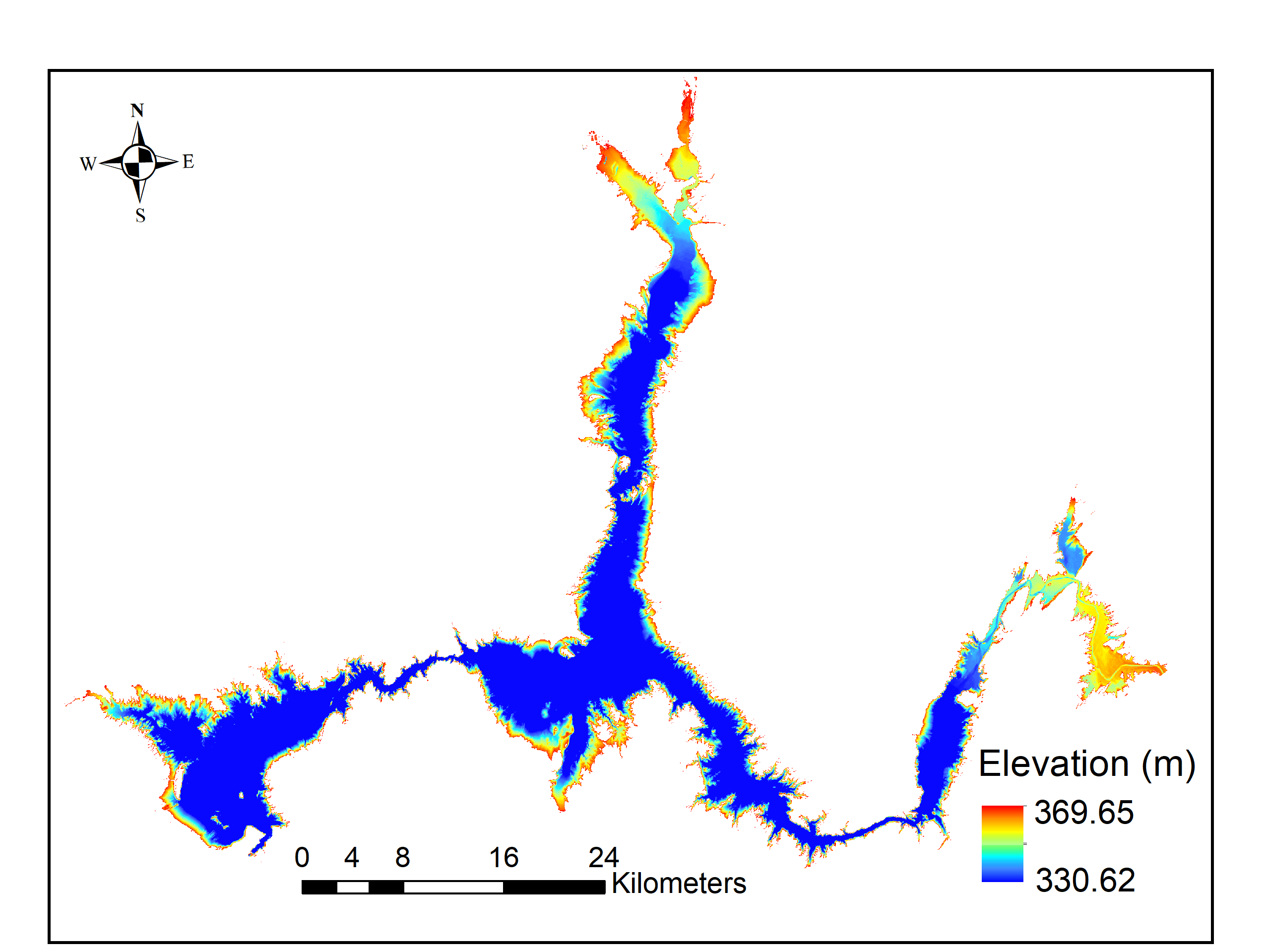
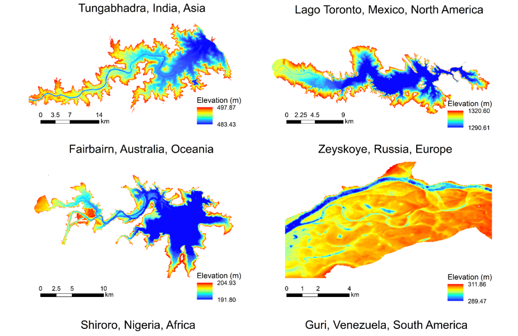
- Lake bathymetry and storage
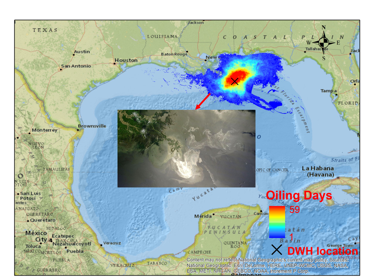
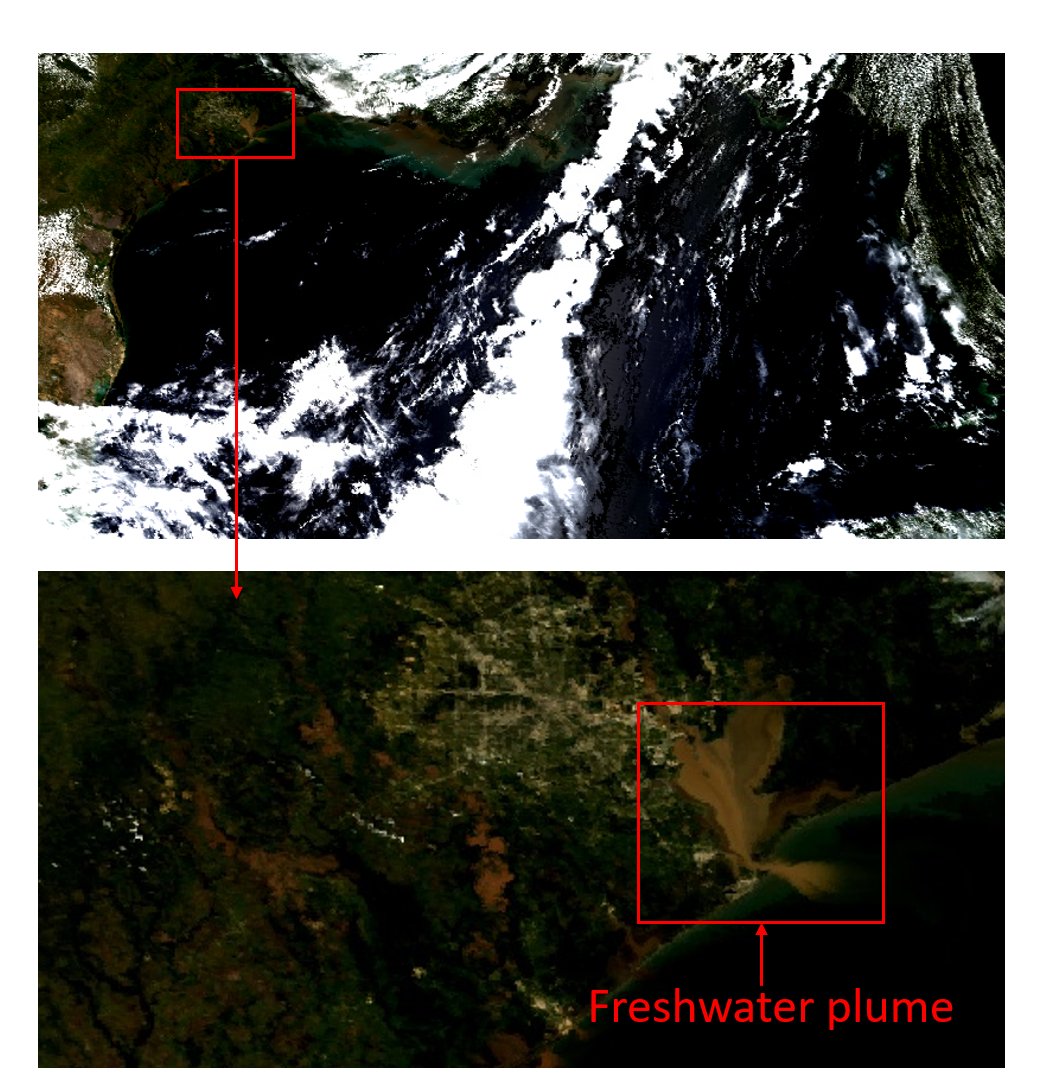
- Coastal ocean pollutions
- Ocean color
Education
-
Ph.D. in Civil Engineering, 2020
Texas A&M University, College Station
-
Ph.D. in Cartography and GIS, 2017
University of Chinese Academic of Sciences
-
B.Sc. in GIS, 2012
China University of Geoscience, Beijing